


Whitman, Asotin, Adams, Lincoln, Columbia & Garfield Counties PUMA, Washington
About
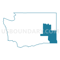
Outline

Summary
| Unique Area Identifier | 194325 |
| Name | Whitman, Asotin, Adams, Lincoln, Columbia & Garfield Counties PUMA |
| State | Washington |
| Area (square miles) | 8,679.14 |
| Land Area (square miles) | 8,610.09 |
| Water Area (square miles) | 69.05 |
| % of Land Area | 99.20 |
| % of Water Area | 0.80 |
| Latitude of the Internal Point | 46.94641480 |
| Longtitude of the Internal Point | -118.02231290 |
Maps

Graphs
Select a template below for downloading or customizing gragh for Whitman, Asotin, Adams, Lincoln, Columbia & Garfield Counties PUMA, Washington


Neighbors
Neighoring Public Use Microdata Area (by Name) Neighboring Public Use Microdata Area on the Map
- Bonner, Latah, Shoshone, Boundary, Benewah & Kootenai (Southeast) Counties PUMA, ID
- Central Idaho--Lewiston City & Nez Perce Reservation PUMA, ID
- Grant & Kittitas Counties PUMA, WA
- Spokane County (Outer)--Cheney City PUMA, WA
- Stevens, Okanogan, Pend Oreille & Ferry Counties PUMA, WA
- Umatilla, Union, Baker & Wallowa Counties PUMA, OR
- Walla Walla, Benton (Outer) & Franklin (Outer) Counties PUMA, WA
Top 10 Neighboring County (by Population) Neighboring County on the Map
- Spokane County, WA (471,221)
- Grant County, WA (89,120)
- Franklin County, WA (78,163)
- Umatilla County, OR (75,889)
- Walla Walla County, WA (58,781)
- Whitman County, WA (44,776)
- Stevens County, WA (43,531)
- Okanogan County, WA (41,120)
- Nez Perce County, ID (39,265)
- Latah County, ID (37,244)
Top 10 Neighboring County Subdivision (by Population) Neighboring County Subdivision on the Map
- Lewiston CCD, Nez Perce County, ID (34,319)
- Pullman CCD, Whitman County, WA (31,900)
- Moscow CCD, Latah County, ID (26,914)
- Cheney-Medical Lake CCD, Spokane County, WA (24,273)
- Clarkston CCD, Asotin County, WA (17,319)
- Mattawa-Royal City CCD, Grant County, WA (14,870)
- Othello CCD, Adams County, WA (14,543)
- Airway Heights CCD, Spokane County, WA (13,183)
- Milton-Freewater CCD, Umatilla County, OR (10,851)
- Loon Lake CCD, Stevens County, WA (10,651)
Top 10 Neighboring Place (by Population) Neighboring Place on the Map
- Lewiston city, ID (31,894)
- Pullman city, WA (29,799)
- Moscow city, ID (23,800)
- Othello city, WA (7,364)
- Clarkston city, WA (7,229)
- Clarkston Heights-Vineland CDP, WA (6,326)
- West Clarkston-Highland CDP, WA (5,261)
- Colfax city, WA (2,805)
- Dayton city, WA (2,526)
- Davenport city, WA (1,734)
Top 10 Neighboring Unified School District (by Population) Neighboring Unified School District on the Map
- Walla Walla School District, WA (37,579)
- Lewiston Independent School District 340, ID (34,136)
- Cheney School District, WA (33,075)
- Pullman School District, WA (31,922)
- Moscow School District 281, ID (27,525)
- Clarkston School District, WA (18,461)
- Othello School District, WA (14,916)
- Milton-Freewater School District 7, OR (11,750)
- North Franklin School District, WA (9,182)
- Wahluke School District, WA (8,342)
Top 10 Neighboring State Legislative District Lower Chamber (by Population) Neighboring State Legislative District Lower Chamber on the Map
- State House District 16, WA (154,830)
- State House District 13, WA (143,750)
- State House District 9, WA (136,166)
- State House District 12, WA (132,531)
- State House District 7, WA (130,475)
- State House District 57, OR (57,718)
- State House District 7, ID (39,265)
- State House District 6, ID (37,244)
- State House District 2, ID (35,917)
Top 10 Neighboring State Legislative District Upper Chamber (by Population) Neighboring State Legislative District Upper Chamber on the Map
- State Senate District 16, WA (154,830)
- State Senate District 13, WA (143,750)
- State Senate District 9, WA (136,166)
- State Senate District 12, WA (132,531)
- State Senate District 7, WA (130,475)
- State Senate District 29, OR (119,818)
- State Senate District 7, ID (39,265)
- State Senate District 6, ID (37,244)
- State Senate District 2, ID (35,917)
Top 10 Neighboring 111th Congressional District (by Population) Neighboring 111th Congressional District on the Map
- Congressional District 1, ID (841,930)
- Congressional District 4, WA (774,409)
- Congressional District 2, OR (769,987)
- Congressional District 5, WA (723,609)
Top 10 Neighboring Census Tract (by Population) Neighboring Census Tract on the Map
- Census Tract 114.02, Grant County, WA (13,025)
- Census Tract 208, Franklin County, WA (8,296)
- Census Tract 9514, Stevens County, WA (7,781)
- Census Tract 51, Latah County, ID (7,583)
- Census Tract 6, Whitman County, WA (7,383)
- Census Tract 104.02, Spokane County, WA (6,937)
- Census Tract 9503, Adams County, WA (6,934)
- Census Tract 2, Whitman County, WA (6,543)
- Census Tract 1, Whitman County, WA (6,520)
- Census Tract 54, Latah County, ID (6,435)
Top 10 Neighboring 5-Digit ZIP Code Tabulation Area (by Population) Neighboring 5-Digit ZIP Code Tabulation Area on the Map
- 99362, WA (41,056)
- 83501, ID (34,230)
- 99163, WA (31,404)
- 83843, ID (25,866)
- 99403, WA (19,548)
- 99004, WA (18,376)
- 99344, WA (16,817)
- 99022, WA (8,820)
- 99349, WA (8,483)
- 99326, WA (4,956)